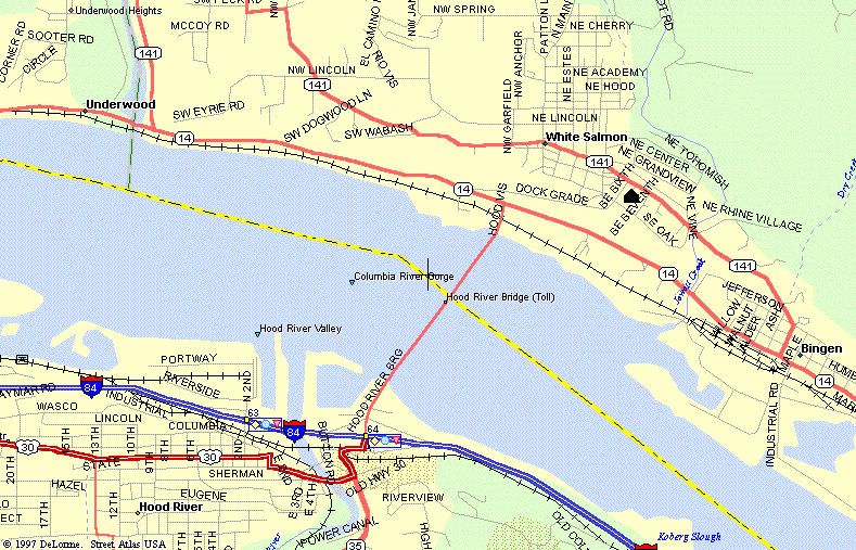
Of where Jenn and Rusty are living and working in the Columbia River Gorge area
|
Maps
Of where Jenn and Rusty are living and working in the Columbia River Gorge area |
So you've been wondering where we are now...
The black house symbol on the map shows where
we live.
The elevation drop from the house to the bridge
is about 450 feet in a very short distance (1/4 mile approx).
Needless to say - the view is incredible!
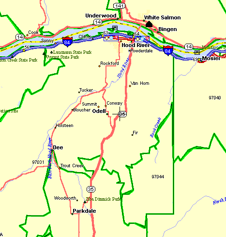
This is a map of our daily commute up to Parkdale.
Mt. Hood is just off the map to the South
[PageOne]
[Rusty]
[Jupiter]
[Cool]
[Portfolio]
[Firefighting]
[LatestGreatest]
Page
& Images - Copyright 1998 - Rusty Coonfield
[email protected]